
An estimated quarter-million lines of code were required for computer-generated imagery in the movie “Twister,” giving audiences a big-screen view of simulated tornadoes. But that’s only a fraction of the technology required to track the real storms. University of Oklahoma radar engineers have already created approximately 1.8 million lines of code to operate the most advanced weather radar in the world.Ā
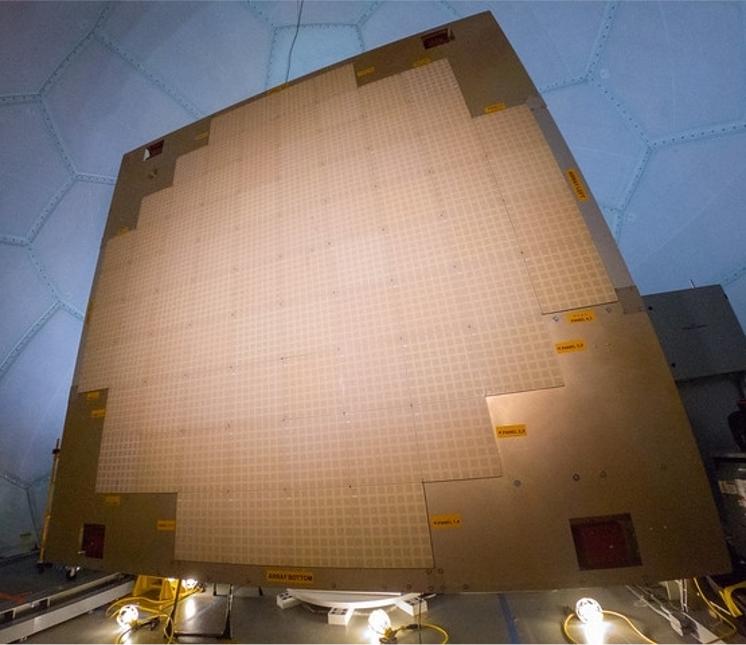
Engineers on the Advanced Radar Techniques (ART) team at the Cooperative Institute for Severe and High-Impact Research and Operations (CIWRO) are developing software to translate phenomena in the sky into time-sensitive radar images. The Advanced Technology Demonstrator (ATD) is a state-of-the-art weather radar built by the National Oceanic and Atmospheric Administration (NOAA) in 2018. This phased-array radar scans the skies electronically rather than mechanically. The radar also utilizes dual polarization, which allows scientists to distinguish between different types of precipitation. In 2021, the code developed by ART engineers allowed the ATD to become operational, enabling critical NOAA-funded research to be conducted with this technology.ĀĀ
“The ATD provides unique flexibility for observing the atmosphere. It’s an incredible piece of hardware that needs equally incredible complex software. The software is the brains of the radar and the key to interacting with the hardware,” said Sebastian Torres, assistant director and senior research scientist at CIWRO, the NOAA cooperative institute at OU.ĀĀ
The ATD antenna has over 4,000 smaller antennas that can be electronically controlled to instantaneously aim the radar beam at different parts of the sky. The software must reliably process millions of measurements per second to deliver accurate radar images to meteorologists.ĀĀ
“As if we had a flashlight in a dark room, the ATD can quickly illuminate specific pockets of weather that need more analysis. Storms that are illuminated by the radar beam reflect some of the energy back to the radar, and the software deciphers what the radar measures into information meaningful for meteorologists,” Torres said. To do this, the ATD must process more than 30 million radar measurements per second and be able to distinguish between meteorological and non-meteorological information, such as reflections from buildings or airplanes.Ā
Multi-faceted software drives the data
The ATD, as the first full-size, S-band, dual polarimetric, phased-array radar in the world designed for weather, takes measurements from storms about every minute rather than every five minutes, as with radars currently operated by the NOAA National Weather Service. The speed and uptake in data adds to the complexity of the software needed to drive the radar.Ā
Stephen Gregg, a CIWRO research associate on the ART team, helped develop the software that controls and monitors all aspects of the ATD, from steering the radar beam to displaying radar data to the users.ĀĀ
“At the highest level, we developed a Human Machine Interface (HMI) that allows users to control the radar and display weather information in real time. However, that is only the tip of the iceberg,” Gregg said. “Behind the scenes, we developed high-performance digital signal processors that turn millions of measurements into useful radar data, and robust communication networks to support the hundreds of processes that run on a dozen high-performance computers.”Ā
In addition to theĀrealtimeĀsoftware, the team also developed applications that package weather data for further offline processing and analysis to support meteorological and engineering research.Ā
“Together with NOAA’s construction of the ATD, no one else in the world has accomplished what we’ve done in this realm of emerging radar technology,” said Torres, who recently traveled with several other members of the ART team to the European Conference on Radar in Meteorology and Hydrology in Locarno, Switzerland.Ā
“NOAA and OU have been leaders in the use of phased-array-radar technology for weather observations, and now we are seeing a growing interest in the broader international community,” Torres said. “Engineers across the world are building weather radar prototypes using phased-array antennas. More importantly, our research using these radars is showing the tremendous potential that this technology brings to improve weather warnings and forecasts.”Ā
NOAA’s continual improvements to existing operational weather radars have ensured that the NEXRAD radar network will remain operational until at least 2035. But in looking toward the future, NOAA is exploring several options, including phased-array radar, for 2040 and beyond.ĀScientists recognize that before more radars can be built, the software needs to demonstrate more advanced phased-array-radar capabilities.ĀĀ
The current ATD software consists of both recent development efforts as well as work that was leveraged from previous projects, such as the software that ran the NOAA National Weather Radar Testbed from 2003 to 2016.ĀĀ
“In order to demonstrate new features and concepts of operations that have never been explored on a phased-array radar of this type and scale, the ART team has been developing software to support these advanced capabilities,” Gregg said. “For example, our software supports weather data collections with different types of radar beams, which would allow for faster scanning capabilities. We are currently implementing software to collect weather data while mechanically rotating the antenna, which will allow the team to explore more advanced concepts of operations. As engineers and meteorologists develop new ways to observe the atmosphere, we will continue to develop software that turns these visions into reality.”Ā
Overcoming modern-day challenges
While developing a staggering amount of code – well beyond a cinematic scope – for the ATD and leading global discussions on radar technologies of the future, CIWRO engineers are also developing techniques to continue to improve the performance of the NEXRAD network.Ā
“An important part of our mission is to find new ways to improve the radar data that forecasters have now,” Torres said. “We’re working on innovative ways to process radar signals to produce meteorological data with the best quality possible.”Ā
As the physical and electromagnetic environment become increasingly complex, producing accurate radar data is facing new challenges. One challenge for engineers is the growing number of wind turbines in rural areas. When the radar beam scans past a wind farm, the energy reflected by wind turbines can contaminate weather signals and lead to errors in the data.Ā
“As renewable energy continues to grow, more and more wind farms are being built within the line of sight of weather radars, and, currently, no solution exists to identify and mitigate contamination from wind turbines in real time,” said Feng Nai, a research scientist on CIWRO’s ART team. “We are leading the effort to develop an operational signal processing technique for the current radar network that could help mitigate wind turbine contamination and deliver cleaner data to meteorologists.”ĀĀ
Another challenge faced by weather radars is the continuous reduction in the available electromagnetic spectrum. As the telecom industry starts to operate in frequency bands neighboring the weather radar bands, CIWRO engineers are seeing more electromagnetic interference (EMI) in the weather data.ĀĀ
“To help NOAA address this challenge, we are looking at this problem from both sides,” Nai said. “On one hand, we are exploring how signal processing techniques might help improve the radar’s ability to detect and mitigate EMI. On the other hand, based on how the EMI negatively impacts the radar data quality, we are conceptualizing how systems trying to operate in the same frequency band may best coexist in ways that minimize interference-related impacts to radar data quality.”Ā
Torres stressed how important it is for weather radar technology to keep up with a world that is rapidly changing.ĀĀ
“Sometimes,ĀtechnologicalĀadvancements create new challenges for weather radars that engineers must overcome. Other times, these advances create unique opportunities that can be leveraged to improve the information that weather radars provide to forecasters. Weather observation needs are constantly evolving, and we must evolve with them; there’s just too much at stake,” Torres said.ĀĀ
“At the core of our mission is the development of weather radar technology that can deliver meteorological data with the best quality and as quickly as possible. When you are in the business of saving lives and protecting property, every minute counts, and we want to help NOAA provide forecasters with the best possible tools.” Ā